Severe Weather Outlook
new youtube channel - we've just launched a new experimental youtube channel over at tornado HQ, including severe weather outlook videos.
National Severe Weather Outlook for the next week
Here you'll find all available severe weather outlooks on one page.
Overview of the threat for the next few days
Outlook for Saturday, May 18
Outlook Summary
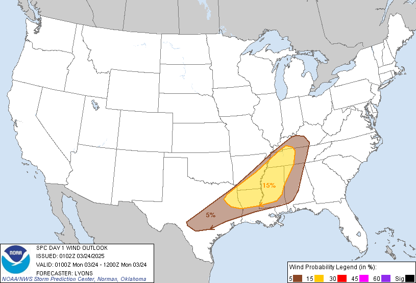
The greatest severe-thunderstorm potential today appears to be from the Florida Panhandle eastward to the southern Atlantic Coast, with damaging gusts the main concern.
Outlook Images
Detailed Outlook
← back to overviewSPC AC 181257
Day 1 Convective Outlook NWS Storm Prediction Center Norman OK 0757 AM CDT Sat May 18 2024
Valid 181300Z - 191200Z
THERE IS A SLIGHT RISK OF SEVERE THUNDERSTORMS FROM PARTS OF NORTHERN FLORIDA AND THE FLORIDA PANHANDLE TO PORTIONS OF THE SOUTHERN ATLANTIC COAST
### SUMMARY
The greatest severe-thunderstorm potential today appears to be from the Florida Panhandle eastward to the southern Atlantic Coast, with damaging gusts the main concern.
Synopsis
Distinct northern- and southern-stream features over nearly opposite parts of the CONUS will continue to exert the greatest influence on severe-thunderstorm potential. In the North, a well-developed, zonal to cyclonic mid/upper-level jet core was evident from the coastal Northwest to the northern Plains. Some amplification in that belt is likely overnight, as a shortwave trough digs southeastward across the Pacific Northwest.
Downstream, a compact but strong shortwave trough – evident in moisture-channel imagery over western ND and southeastern SK – should move east-northeastward to southern MB and northern MN by 00Z, forming a closed 500-mb low over the Lake Winnipeg vicinity. The attached trough should eject northeastward to northwestern ON by 12Z tomorrow. The associated surface cold front – drawn at 11Z over eastern MN to near FSD, EAR, GLD and PUB – should reach Lake Superior, northern WI, central IA, and south-central KS by 00Z, stalling across southwestern KS into eastern CO. By 12Z, the front should reach northern Lower MI, northern to west-central IL, and northern MO, while moving northward as a warm front near the I-70 corridor in KS.
Meanwhile, a positively tilted mid/upper-level shortwave trough – with several associated vorticity maxima – was evident in moisture-channel imagery from KY across the Mid-South to south-central TX. The main vorticity lobe – now over the northeastern AR/western TN area – should shift eastward to middle TN by 00Z, with trough southwestward to TX shelf waters of the Gulf. By 12Z, the trough should extend from the western Carolinas across southern AL. The associated surface low – analyzed at 11Z near MEM – should move eastward today and devolve into a weak trough. An outflow-reinforced marine front was analyzed over shelf waters off the middle Texas Coast to just southeast of the Mississippi River mouth to near PNS, then across southern parts of GA and SC. This boundary should drift eastward over the north-central Gulf Coast region and across GA.
Southeast
Scattered thunderstorms in clusters – including occasional/embedded supercells – have been persistent this morning just offshore from the LA/MS/AL coastline to near the western FL Panhandle, reinforcing the marine/outflow boundary on the southern margins of that convection. That, and persistent rainfall north of the boundary across southeastern LA to the AL Gulf Coast, have led to decreasing unconditional severe potential over those areas.
Instead, the greatest threat today should be with the eastern/inland extent of the loosely organized Gulf convective plume, which extends along and north of the boundary over the FL Panhandle and southern GA. Damaging wind will be the main concern, with a tornado or two possible, and isolated large hail. This region should continue to exhibit the greatest low-level moisture/instability through the day as the convection undergoes a net eastward shift, with surface dewpoints commonly in the 70s F, areas of cloud-tempered diurnal heating, weak MLCINH and MLCAPE reaching the 2000-2500 J/kg range. Deep shear will favor organized convection, with effective-shear vectors continuing to be commonly in the 40-50-kt range – albeit aligned with a substantial component parallel to the main swath of convective lift. As such, mode should remain somewhat messy, clustered to linear, with some embedded supercell/bow structures possible.
Elsewhere, less-organized convection (mainly due to weaker shear) should occur near the peninsular FL Atlantic Coast, and ahead of the midlevel vorticity lobe and surface low/trough, from the Mid-South across the Tennessee Valley. Isolated damaging gusts and marginally severe hail will be possible.
Midwest
Thunderstorms should develop from mid/late afternoon into early evening along the cold front – with coverage diminishing from scattered across the Lake Superior and WI/northeastern IA regions to widely scattered or isolated from southern IA to portions of KS. Damaging gusts will be the main concern, though any sustained, relatively discrete cell may rotate and produce locally large hail as well.
Development should occur later over the MO/KS segment than farther north, due to the presence of capping related to an EML. The strongest flow aloft and deep shear should remain behind the surface front, with effective-shear magnitudes generally ranging from around 45-50 kt over the MN Arrowhead to less than 30 kt over southeastern KS. Low/middle-level lapse rates and boundary-layer moisture also should increase with southward extent, but the opposite will be true for deep-layer lift/forcing. A narrow corridor of favorable MLCAPE should develop today ahead of the front, ranging from around 1000 J/kg either side of western Lake Superior to 2000 J/kg over east- central KS. These offsetting factors and the probable quick evolution to quasi-linear mode in northern areas – combined with a narrow east-west and temporal window for the most vigorous convection before nocturnal stabilization contribute to weakening – support keeping unconditional probabilities at marginal levels for this update.
Central High Plains
Widely scattered, high-based, somewhat skeletal thunderstorms are expected to develop over the mountains and foothills of central/ south-central CO this afternoon near the front, and move east-northeastward over the adjoining High Plains from late afternoon into parts of tonight. The main concern will be isolated strong-severe downbursts. Activity will be supported initially by diurnal heating of higher terrain, with marginal but adequate moisture to support convection at those altitudes. While strong gusts are possible in the mountains, the activity should move atop a deep, well-mixed subcloud layer over the downshear central High Plains. That deep boundary layer will be characterized by nearly dry-adiabatic lapse rates, and enough moisture to support 200-500 J/kg MLCAPE. Eastward extent of the threat is uncertain, but in general, should diminish overnight as nocturnal stabilizing of the near-surface profile proceeds.
..Edwards/Goss.. 05/18/2024
CLICK TO GET WUUS01 PTSDY1 PRODUCT
NOTE: THE NEXT DAY 1 OUTLOOK IS SCHEDULED BY 1630Z
Outlook for Sunday, May 19
Outlook Summary
Severe thunderstorms are most likely across parts of Kansas Sunday afternoon and evening. Significant damaging gusts, large to very large hail, and a few tornadoes all appear possible.
Outlook Images
Detailed Outlook
← back to overviewSPC AC 180550
Day 2 Convective Outlook NWS Storm Prediction Center Norman OK 1250 AM CDT Sat May 18 2024
Valid 191200Z - 201200Z
THERE IS AN ENHANCED RISK OF SEVERE THUNDERSTORMS ACROSS PORTIONS OF WESTERN AND CENTRAL KANSAS
### SUMMARY
Severe thunderstorms are most likely across parts of Kansas Sunday afternoon and evening. Significant damaging gusts, large to very large hail, and a few tornadoes all appear possible.
NE/KS/OK
A weak upper shortwave impulse over NE Sunday morning will quickly lift northeast. Some convection may be ongoing across NE/KS during the morning, but is forecast to quickly weaken/shift east. This early activity may suppress severe potential across northeast NE during the afternoon as airmass recovery is uncertain. By afternoon, another upper shortwave trough is forecast to eject from the southern/central Rockies into KS, and then the Lower MO Valley by Monday morning. This secondary shortwave trough will be the focus for the primary severe risk during the afternoon/evening.
A surface dryline is forecast to extend southward from near the NE/KS/CO border into western KS and then near the OK/TX border. To the east of the dryline, dewpoints into the low/mid 60s are expected across OK into central/eastern KS (somewhat lower across northern KS and southern NE). Very steep midlevel lapse rates (greater than 8 C/km) will be in place. Capping will suppress convection until mid/late afternoon, when large-scale ascent increases amid strong heating and continued warm/moist advection. High-based storms along the dryline will initially pose a risk of large hail and damaging gusts. Forecast guidance (including HREF and CAMs) show a strong signal for upscale growth into an intense bow is possible across KS. Upscale growth is possible via consolidating outflow and an increasing low-level jet during the late afternoon/early evening. Significant gusts will be possible if this scenario evolves as expected. Large to very hail and a few tornadoes also will be possible. Hail greater than 2 inches in diameter will be possible early in convective evolution, but eastward extent of this risk is uncertain and dependent on storm mode.
Severe potential southward along the dryline into western OK is more uncertain and conditional. If a storm can develop and be maintained, all severe hazards would be possible, particularly very large hail and damaging gusts.
SD vicinity
Southerly low-level flow will transport mid/upper 50s F dewpoints northward into northern NE/SD and southern ND. A cold front is forecast to develop eastward during the late Sunday afternoon into Sunday night. Steep midlevel lapse rates will be in place, but an EML will likely limit a greater severe risk. Nevertheless, MUCAPE to around 1500 J/kg will support elevated convection ahead of the cold front. Isolated hail will be the main risk. However, if an organized line of storms can develop, some gusty winds also are possible.
Lower MO Valley toward the Mid-MS Valley
Convection from NE/KS may dissipate over the area during the morning. However, a warm front is expected to slowly lift northward through the day, allowing from some airmass recovery and destabilization. Convection may redevelop near this boundary during the afternoon. This activity may produce marginally severe hail and gusty winds.
FL
An upper trough from the Mid-Atlantic to the northern Gulf will shift east over the Atlantic on Sunday. A belt of enhanced west/southwesterly flow (30-40 kt at 700 mb) will overspread the FL peninsula ahead of the trough. Mid to upper 60s F surface dewpoints and strong heating will contribute to MLCAPE values around 1500-2500 J/kg. Steep low-level lapse rates will support isolated strong gusts in water-loaded downdrafts. Elongated/straight forecast hodographs and modest midlevel lapse rates (6.5-7 C/km) suggest isolated large hail also is possible. Effective shear around 30 kt suggests organized updrafts may be somewhat transient. If confidence increases regarding coverage of organized severe convection, higher probabilities may be needed in subsequent outlooks.
..Leitman.. 05/18/2024
CLICK TO GET WUUS02 PTSDY2 PRODUCT
NOTE: THE NEXT DAY 2 OUTLOOK IS SCHEDULED BY 1730Z
Outlook for Monday, May 20
Outlook Summary
Severe thunderstorms are possible across parts of Nebraska and Kansas into western Iowa and northwest Missouri Monday afternoon into Monday night. More isolated strong to severe storms may extend into parts of the Middle Mississippi Valley and southern Wisconsin.
Outlook Images
Detailed Outlook
← back to overviewSPC AC 180727
Day 3 Convective Outlook NWS Storm Prediction Center Norman OK 0227 AM CDT Sat May 18 2024
Valid 201200Z - 211200Z
THERE IS A SLIGHT RISK OF SEVERE THUNDERSTORMS ACROSS PORTIONS OF NEBRASKA…KANSAS…SOUTHWEST IOWA AND NORTHWEST MISSOURI
### SUMMARY
Severe thunderstorms are possible across parts of Nebraska and Kansas into western Iowa and northwest Missouri Monday afternoon into Monday night. More isolated strong to severe storms may extend into parts of the Middle Mississippi Valley and southern Wisconsin.
Synopsis
An upper shortwave trough is expected to be located over the Lower MO Valley early Monday. This trough will lift northeast across the upper Great Lakes through Monday night. Meanwhile, a broad area of southwesterly flow will continued across the southern/central Plains east of a deepening upper trough over the western U.S. Deep-layer flow will become more amplified and stronger across the central Plains after 00z, as the western trough ejects east toward the High Plains by early Tuesday.
At the surface, a cold front will be located from the eastern Dakotas into central NE. This front will continue to shift east through the evening before stalling from southern MN into eastern NE and central KS. Southerly low-level flow ahead of the front will result in a broad area of low to mid 60s F dew points from the Mid/Upper MS Valley into the central/southern Plains.
KS/NE into southwest IA/northwest MO
Large-scale ascent will be nebulous through the afternoon, and capping will likely suppress convection through at least mid-afternoon. Thereafter, vertical shear will increase along with stronger ascent spreading into the Plains during the evening/overnight as the western trough ejects east. Thunderstorm clusters may initiate by early evening, with the potential for MCS development during the nighttime hours. Convective initiation and evolution is a bit uncertain given several rounds of convection expected for portions of the region prior to Monday evening. However, the overall large-scale pattern supports severe convection capable of all hazards into early Tuesday morning.
Lower MO Valley to WI
Convection may be ongoing Monday morning from the MO River into central IA, northward into northern WI. How this convection evolves is a bit uncertain. However, some severe potential appears possible into the afternoon, as at least modest destabilization occurs amid somewhat favorable vertical shear. Hail and strong gusts will be possible with this activity through Monday evening.
..Leitman.. 05/18/2024
CLICK TO GET WUUS03 PTSDY3 PRODUCT
NOTE: THE NEXT DAY 3 OUTLOOK IS SCHEDULED BY 0730Z
Outlook for Tuesday, May 21
Outlook Images
Note on Medium Range Outlooks
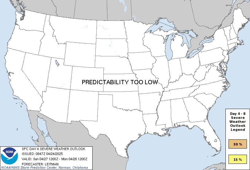
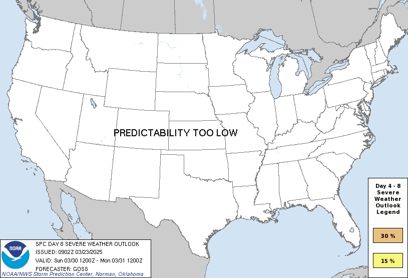
You are looking at an outlook that is part of the medium range forecast (the outlook for days 4-8). The most important thing to note is that lack of a risk does not mean zero risk. Generally speaking, confidence has to be pretty high for the Storm Prediction Center to have an outlook area this far into the future.
If you bookmark this page, it will continue to update with each new outlook that is issued.
Detailed Outlook
← back to overviewZCZC SPCSWOD48 ALL ACUS48 KWNS 180858 SPC AC 180858
Day 4-8 Convective Outlook NWS Storm Prediction Center Norman OK 0358 AM CDT Sat May 18 2024
Valid 211200Z - 261200Z
DISCUSSION
Day 4/Tue – Southern Plains to the Mid/Upper MS Valley
Medium-range guidance has been fairly consistent the past several cycles in showing a negatively tilted upper shortwave trough ejecting across the central Plains to the upper Great Lakes on Tuesday. As this occurs, a surface cyclone over NE/KS will deepen and track northeast to MN/WI by 06z. As this occurs, a surface cold front will develop east across the region, becoming oriented from near Lake Michigan southwestward to northwest TX by Wednesday morning. Across the warm sector, mid/upper 60s F dewpoints will be widespread, aiding in moderate to strong destabilization during the day. Storms will likely develop by early afternoon near the surface low and cold front across western IA southward into eastern KS. The current expectation is that a linear MCS will evolve over IA/MO and shift east through the evening. While damaging gusts will be the primary hazard, large hail and tornadoes also will be possible.
With southward extent into OK and portions of the Ozarks, convective coverage may be less. This area will be further removed from stronger large-scale ascent, and capping may erode less efficiently as a result. Nevertheless, where storms can develop, supercell wind profiles amid a very moist and unstable airmass will support an all-hazards risk.
Day 5/Wed – ArkLaTex to the Ohio Valley
Forecast guidance differs quite a bit on Wednesday with regards to the evolving the upper trough/low over the Great Lakes. The surface cold front will likely continue eastward into parts of the Ohio Valley. A moist airmass will be in place, but degree of downstream destabilization ahead of likely ongoing convection Wednesday morning is uncertain.
The front will likely stall across the Mid-South into the southern Plains as upper support moves well north of the region. This could focus severe-thunderstorm potential during the afternoon along the stalled boundary. However, capping may be a concern given weak forcing aloft and a generally low-amplitude upper pattern over the region.
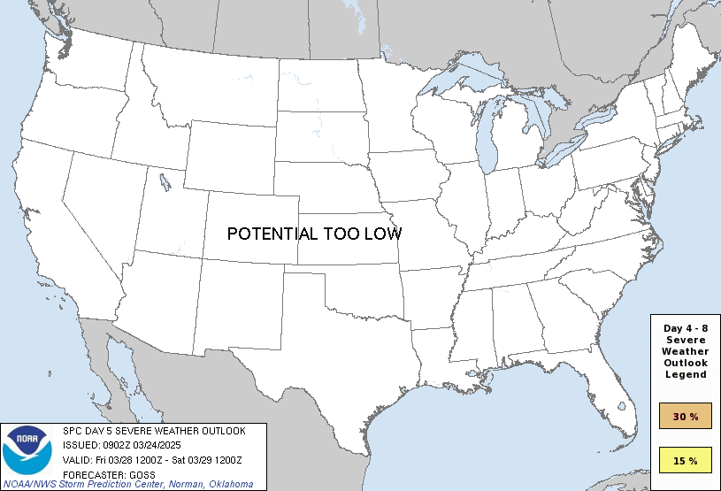
While some severe potential will exist across this broad region, confidence is too low to include a 15 percent area at this time.
Days 6-8/Thu-Sat
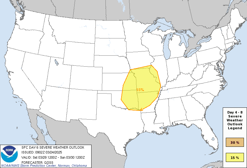
Most guidance maintains a mean upper trough over the western U.S. late in the period. An upper shortwave trough is forecast to eject eastward across the southern Plains to the Lower MS Valley Day 6/Thu. A very moist and unstable airmass will already be in place as favorable vertical shear and large-scale ascent overspread the region, likely resulting in severe-thunderstorm potential across parts of OK into the ArkLaTex.
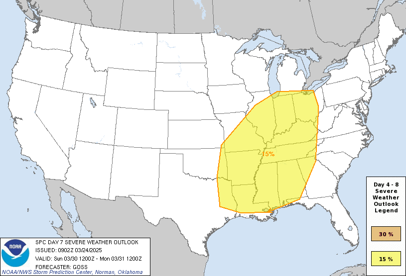
By Day 7/Fri, spread among forecast guidance increases considerably and predictability is low.
..Leitman.. 05/18/2024
CLICK TO GET WUUS48 PTSD48 PRODUCT
Outlook for Wednesday, May 22
Outlook Images
Note on Medium Range Outlooks
You are looking at an outlook that is part of the medium range forecast (the outlook for days 4-8). The most important thing to note is that lack of a risk does not mean zero risk. Generally speaking, confidence has to be pretty high for the Storm Prediction Center to have an outlook area this far into the future.
If you bookmark this page, it will continue to update with each new outlook that is issued.
Detailed Outlook
← back to overviewZCZC SPCSWOD48 ALL ACUS48 KWNS 180858 SPC AC 180858
Day 4-8 Convective Outlook NWS Storm Prediction Center Norman OK 0358 AM CDT Sat May 18 2024
Valid 211200Z - 261200Z
DISCUSSION
Day 4/Tue – Southern Plains to the Mid/Upper MS Valley
Medium-range guidance has been fairly consistent the past several cycles in showing a negatively tilted upper shortwave trough ejecting across the central Plains to the upper Great Lakes on Tuesday. As this occurs, a surface cyclone over NE/KS will deepen and track northeast to MN/WI by 06z. As this occurs, a surface cold front will develop east across the region, becoming oriented from near Lake Michigan southwestward to northwest TX by Wednesday morning. Across the warm sector, mid/upper 60s F dewpoints will be widespread, aiding in moderate to strong destabilization during the day. Storms will likely develop by early afternoon near the surface low and cold front across western IA southward into eastern KS. The current expectation is that a linear MCS will evolve over IA/MO and shift east through the evening. While damaging gusts will be the primary hazard, large hail and tornadoes also will be possible.
With southward extent into OK and portions of the Ozarks, convective coverage may be less. This area will be further removed from stronger large-scale ascent, and capping may erode less efficiently as a result. Nevertheless, where storms can develop, supercell wind profiles amid a very moist and unstable airmass will support an all-hazards risk.
Day 5/Wed – ArkLaTex to the Ohio Valley
Forecast guidance differs quite a bit on Wednesday with regards to the evolving the upper trough/low over the Great Lakes. The surface cold front will likely continue eastward into parts of the Ohio Valley. A moist airmass will be in place, but degree of downstream destabilization ahead of likely ongoing convection Wednesday morning is uncertain.
The front will likely stall across the Mid-South into the southern Plains as upper support moves well north of the region. This could focus severe-thunderstorm potential during the afternoon along the stalled boundary. However, capping may be a concern given weak forcing aloft and a generally low-amplitude upper pattern over the region.
While some severe potential will exist across this broad region, confidence is too low to include a 15 percent area at this time.
Days 6-8/Thu-Sat
Most guidance maintains a mean upper trough over the western U.S. late in the period. An upper shortwave trough is forecast to eject eastward across the southern Plains to the Lower MS Valley Day 6/Thu. A very moist and unstable airmass will already be in place as favorable vertical shear and large-scale ascent overspread the region, likely resulting in severe-thunderstorm potential across parts of OK into the ArkLaTex.
By Day 7/Fri, spread among forecast guidance increases considerably and predictability is low.
..Leitman.. 05/18/2024
CLICK TO GET WUUS48 PTSD48 PRODUCT
Outlook for Thursday, May 23
Outlook Images
Note on Medium Range Outlooks
You are looking at an outlook that is part of the medium range forecast (the outlook for days 4-8). The most important thing to note is that lack of a risk does not mean zero risk. Generally speaking, confidence has to be pretty high for the Storm Prediction Center to have an outlook area this far into the future.
If you bookmark this page, it will continue to update with each new outlook that is issued.
Detailed Outlook
← back to overviewZCZC SPCSWOD48 ALL ACUS48 KWNS 180858 SPC AC 180858
Day 4-8 Convective Outlook NWS Storm Prediction Center Norman OK 0358 AM CDT Sat May 18 2024
Valid 211200Z - 261200Z
DISCUSSION
Day 4/Tue – Southern Plains to the Mid/Upper MS Valley
Medium-range guidance has been fairly consistent the past several cycles in showing a negatively tilted upper shortwave trough ejecting across the central Plains to the upper Great Lakes on Tuesday. As this occurs, a surface cyclone over NE/KS will deepen and track northeast to MN/WI by 06z. As this occurs, a surface cold front will develop east across the region, becoming oriented from near Lake Michigan southwestward to northwest TX by Wednesday morning. Across the warm sector, mid/upper 60s F dewpoints will be widespread, aiding in moderate to strong destabilization during the day. Storms will likely develop by early afternoon near the surface low and cold front across western IA southward into eastern KS. The current expectation is that a linear MCS will evolve over IA/MO and shift east through the evening. While damaging gusts will be the primary hazard, large hail and tornadoes also will be possible.
With southward extent into OK and portions of the Ozarks, convective coverage may be less. This area will be further removed from stronger large-scale ascent, and capping may erode less efficiently as a result. Nevertheless, where storms can develop, supercell wind profiles amid a very moist and unstable airmass will support an all-hazards risk.
Day 5/Wed – ArkLaTex to the Ohio Valley
Forecast guidance differs quite a bit on Wednesday with regards to the evolving the upper trough/low over the Great Lakes. The surface cold front will likely continue eastward into parts of the Ohio Valley. A moist airmass will be in place, but degree of downstream destabilization ahead of likely ongoing convection Wednesday morning is uncertain.
The front will likely stall across the Mid-South into the southern Plains as upper support moves well north of the region. This could focus severe-thunderstorm potential during the afternoon along the stalled boundary. However, capping may be a concern given weak forcing aloft and a generally low-amplitude upper pattern over the region.
While some severe potential will exist across this broad region, confidence is too low to include a 15 percent area at this time.
Days 6-8/Thu-Sat
Most guidance maintains a mean upper trough over the western U.S. late in the period. An upper shortwave trough is forecast to eject eastward across the southern Plains to the Lower MS Valley Day 6/Thu. A very moist and unstable airmass will already be in place as favorable vertical shear and large-scale ascent overspread the region, likely resulting in severe-thunderstorm potential across parts of OK into the ArkLaTex.
By Day 7/Fri, spread among forecast guidance increases considerably and predictability is low.
..Leitman.. 05/18/2024
CLICK TO GET WUUS48 PTSD48 PRODUCT
Outlook for Friday, May 24
Outlook Images
Note on Medium Range Outlooks
You are looking at an outlook that is part of the medium range forecast (the outlook for days 4-8). The most important thing to note is that lack of a risk does not mean zero risk. Generally speaking, confidence has to be pretty high for the Storm Prediction Center to have an outlook area this far into the future.
If you bookmark this page, it will continue to update with each new outlook that is issued.
Detailed Outlook
← back to overviewZCZC SPCSWOD48 ALL ACUS48 KWNS 180858 SPC AC 180858
Day 4-8 Convective Outlook NWS Storm Prediction Center Norman OK 0358 AM CDT Sat May 18 2024
Valid 211200Z - 261200Z
DISCUSSION
Day 4/Tue – Southern Plains to the Mid/Upper MS Valley
Medium-range guidance has been fairly consistent the past several cycles in showing a negatively tilted upper shortwave trough ejecting across the central Plains to the upper Great Lakes on Tuesday. As this occurs, a surface cyclone over NE/KS will deepen and track northeast to MN/WI by 06z. As this occurs, a surface cold front will develop east across the region, becoming oriented from near Lake Michigan southwestward to northwest TX by Wednesday morning. Across the warm sector, mid/upper 60s F dewpoints will be widespread, aiding in moderate to strong destabilization during the day. Storms will likely develop by early afternoon near the surface low and cold front across western IA southward into eastern KS. The current expectation is that a linear MCS will evolve over IA/MO and shift east through the evening. While damaging gusts will be the primary hazard, large hail and tornadoes also will be possible.
With southward extent into OK and portions of the Ozarks, convective coverage may be less. This area will be further removed from stronger large-scale ascent, and capping may erode less efficiently as a result. Nevertheless, where storms can develop, supercell wind profiles amid a very moist and unstable airmass will support an all-hazards risk.
Day 5/Wed – ArkLaTex to the Ohio Valley
Forecast guidance differs quite a bit on Wednesday with regards to the evolving the upper trough/low over the Great Lakes. The surface cold front will likely continue eastward into parts of the Ohio Valley. A moist airmass will be in place, but degree of downstream destabilization ahead of likely ongoing convection Wednesday morning is uncertain.
The front will likely stall across the Mid-South into the southern Plains as upper support moves well north of the region. This could focus severe-thunderstorm potential during the afternoon along the stalled boundary. However, capping may be a concern given weak forcing aloft and a generally low-amplitude upper pattern over the region.
While some severe potential will exist across this broad region, confidence is too low to include a 15 percent area at this time.
Days 6-8/Thu-Sat
Most guidance maintains a mean upper trough over the western U.S. late in the period. An upper shortwave trough is forecast to eject eastward across the southern Plains to the Lower MS Valley Day 6/Thu. A very moist and unstable airmass will already be in place as favorable vertical shear and large-scale ascent overspread the region, likely resulting in severe-thunderstorm potential across parts of OK into the ArkLaTex.
By Day 7/Fri, spread among forecast guidance increases considerably and predictability is low.
..Leitman.. 05/18/2024
CLICK TO GET WUUS48 PTSD48 PRODUCT
Outlook for Saturday, May 25
Outlook Images
Note on Medium Range Outlooks
You are looking at an outlook that is part of the medium range forecast (the outlook for days 4-8). The most important thing to note is that lack of a risk does not mean zero risk. Generally speaking, confidence has to be pretty high for the Storm Prediction Center to have an outlook area this far into the future.
If you bookmark this page, it will continue to update with each new outlook that is issued.
Detailed Outlook
← back to overviewZCZC SPCSWOD48 ALL ACUS48 KWNS 180858 SPC AC 180858
Day 4-8 Convective Outlook NWS Storm Prediction Center Norman OK 0358 AM CDT Sat May 18 2024
Valid 211200Z - 261200Z
DISCUSSION
Day 4/Tue – Southern Plains to the Mid/Upper MS Valley
Medium-range guidance has been fairly consistent the past several cycles in showing a negatively tilted upper shortwave trough ejecting across the central Plains to the upper Great Lakes on Tuesday. As this occurs, a surface cyclone over NE/KS will deepen and track northeast to MN/WI by 06z. As this occurs, a surface cold front will develop east across the region, becoming oriented from near Lake Michigan southwestward to northwest TX by Wednesday morning. Across the warm sector, mid/upper 60s F dewpoints will be widespread, aiding in moderate to strong destabilization during the day. Storms will likely develop by early afternoon near the surface low and cold front across western IA southward into eastern KS. The current expectation is that a linear MCS will evolve over IA/MO and shift east through the evening. While damaging gusts will be the primary hazard, large hail and tornadoes also will be possible.
With southward extent into OK and portions of the Ozarks, convective coverage may be less. This area will be further removed from stronger large-scale ascent, and capping may erode less efficiently as a result. Nevertheless, where storms can develop, supercell wind profiles amid a very moist and unstable airmass will support an all-hazards risk.
Day 5/Wed – ArkLaTex to the Ohio Valley
Forecast guidance differs quite a bit on Wednesday with regards to the evolving the upper trough/low over the Great Lakes. The surface cold front will likely continue eastward into parts of the Ohio Valley. A moist airmass will be in place, but degree of downstream destabilization ahead of likely ongoing convection Wednesday morning is uncertain.
The front will likely stall across the Mid-South into the southern Plains as upper support moves well north of the region. This could focus severe-thunderstorm potential during the afternoon along the stalled boundary. However, capping may be a concern given weak forcing aloft and a generally low-amplitude upper pattern over the region.
While some severe potential will exist across this broad region, confidence is too low to include a 15 percent area at this time.
Days 6-8/Thu-Sat
Most guidance maintains a mean upper trough over the western U.S. late in the period. An upper shortwave trough is forecast to eject eastward across the southern Plains to the Lower MS Valley Day 6/Thu. A very moist and unstable airmass will already be in place as favorable vertical shear and large-scale ascent overspread the region, likely resulting in severe-thunderstorm potential across parts of OK into the ArkLaTex.
By Day 7/Fri, spread among forecast guidance increases considerably and predictability is low.
..Leitman.. 05/18/2024
CLICK TO GET WUUS48 PTSD48 PRODUCT
National Risk Overview
- Saturday, May 18
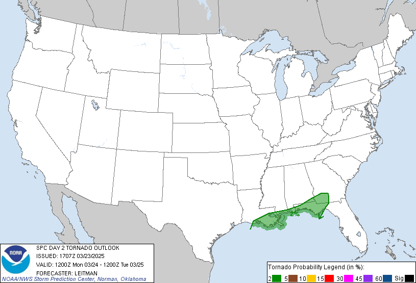
- TORNADO: 2%
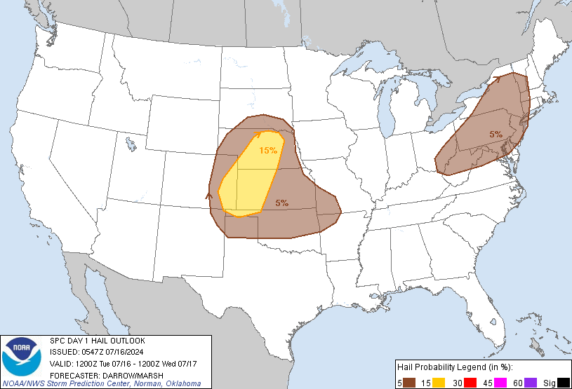
- HAIL: 5%
- WIND: 15%
- Sunday, May 19
- TORNADO: 5%
- HAIL: 15%
- WIND: 30%
- Monday, May 20
- ANY SEVERE: 15%
- Tuesday, May 21
- ANY SEVERE: 30%
- Wednesday, May 22
- ANY SEVERE: low / uncertain
- Thursday, May 23
- ANY SEVERE: 15%
- Friday, May 24
- ANY SEVERE: low / uncertain
- Saturday, May 25
- ANY SEVERE: low / uncertain
Your Severe Outlook
Hey, it looks like your location wasn't detected.
Drag the marker on the map and we'll show you the severe weather potential for a given location.
Hi, I'm Hayley. Did you know that I run this site out of my own pocket? So if you'd like to help out and you're already planning on buying something off of Amazon, why not use our Amazon Severe Weather Outlook link before you buy and we'll get a tiny portion of your purchase.
About Severe Weather Outlook . com
SWO started as a spinoff project of wickedwx, but has since replaced the site.
- tornado hq - live severe weather warnings
- cyclocane - hurricanes/typhoons/cyclones
- tornado solitaire - play cards while you monitor the US severe weather threat
- tertremo - live view of earthquakes around the world
- earthquake solitaire - get live earthquake updates as you play your favorite card game


