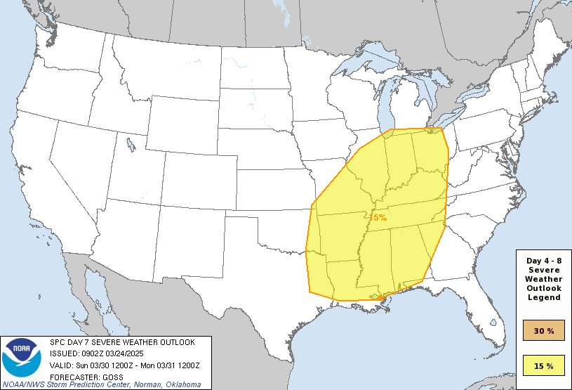
Severe Weather Outlook
Hayley here - Do you like lofi music and terrifyingly loud computer voices? Then stop by the 24/7 ish severe weather live stream!
Outlook for Friday, January 17
Outlook Images
Note on Medium Range Outlooks
You are looking at an outlook that is part of the medium range forecast (the outlook for days 4-8). The most important thing to note is that lack of a risk does not mean zero risk. Generally speaking, confidence has to be pretty high for the Storm Prediction Center to have an outlook area this far into the future.
If you bookmark this page, it will continue to update with each new outlook that is issued.
Detailed Outlook
ZCZC SPCSWOD48 ALL ACUS48 KWNS 110851 SPC AC 110851
Day 4-8 Convective Outlook NWS Storm Prediction Center Norman OK 0251 AM CST Sat Jan 11 2025
Valid 141200Z - 191200Z
DISCUSSION
Strong surface high pressure and a dry/stable airmass will envelop much of the CONUS through Day 6/Thu. By the end of the period around Day 7-8/Fri-Sat, medium range guidance indicates a shortwave upper trough may move across the southern Plains and Southeast. As this occurs, a deepening surface cyclone will develop over the southern Plains and shift east. Strengthening southerly low-level flow ahead of the surface low will allow for Gulf moisture to return northward across portions of south/east Texas into the Gulf coast states. Some severe thunderstorm potential could accompany this system at the end of the forecast period. However, uncertainty and spread in forecast guidance with regards to timing/track of the surface low, and moisture return across the Gulf coast region, precludes severe probabilities at this time.
..Leitman.. 01/11/2025
CLICK TO GET WUUS48 PTSD48 PRODUCT
National Risk Overview
- Saturday, January 11
- TORNADO: low
- HAIL: low
- WIND: low
- Sunday, January 12
- TORNADO: low
- HAIL: low
- WIND: low
- Monday, January 13
- ANY SEVERE: low
- Tuesday, January 14
- ANY SEVERE: low / uncertain
- Wednesday, January 15
- ANY SEVERE: low / uncertain
- Thursday, January 16
- ANY SEVERE: low / uncertain
- Friday, January 17
- ANY SEVERE: low / uncertain
- Saturday, January 18
- ANY SEVERE: low / uncertain
Your Severe Outlook
Hey, it looks like your location wasn't detected.
Drag the marker on the map and we'll show you the severe weather potential for a given location.
Hi, I'm Hayley. Did you know that I run this site out of my own pocket? So if you'd like to help out and you're already planning on buying something off of Amazon, why not use our Amazon Severe Weather Outlook link before you buy and we'll get a tiny portion of your purchase.
About Severe Weather Outlook . com
SWO started as a spinoff project of wickedwx, but has since replaced the site.
- tornado hq - live severe weather warnings
- cyclocane - hurricanes/typhoons/cyclones
- tornado solitaire - play cards while you monitor the US severe weather threat
- tertremo - live view of earthquakes around the world
- earthquake solitaire - get live earthquake updates as you play your favorite card game

