Severe Weather Outlook
Hayley here - Do you like lofi music and terrifyingly loud computer voices? Then stop by the 24/7 ish severe weather live stream!
Outlook for Tuesday, April 1
Outlook Summary
Severe thunderstorms are forecast to develop after dark from central and northeastern Kansas east-northeastward to northwestern Illinois, where large hail would be the main severe risk.
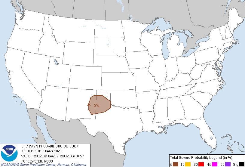
Outlook Images
Detailed Outlook
SPC AC 300732
Day 3 Convective Outlook NWS Storm Prediction Center Norman OK 0232 AM CDT Sun Mar 30 2025
Valid 011200Z - 021200Z
THERE IS A SLIGHT RISK OF SEVERE THUNDERSTORMS ACROSS PARTS OF THE MID MISSOURI/MID MISSISSIPPI VALLEYS
### SUMMARY
Severe thunderstorms are forecast to develop after dark from central and northeastern Kansas east-northeastward to northwestern Illinois, where large hail would be the main severe risk.
Mid Missouri and mid Mississippi Valley, southward into Texas
Cyclonic flow aloft is forecast to amplify over the western U.S. Tuesday, as several short-wave features rotate through the flow. A prominent/initial wave is forecast to shift into the central/northern Plains overnight, evolving into a closed low over the South Dakota/Nebraska area. In response, a surface low over the central High Plains early in the day is forecast to deepen/shift northeastward into the Mid Missouri Valley area overnight. A trailing cold front will shift across the central and southern Plains through the second half of the period.
Diurnal convection ahead of the advancing upper system, and attendant cold front, should remain largely suppressed through the day by stout capping. A dryline storm or two cannot be ruled out, and very limited/conditional potential for hail or a damaging gust may exist across southern Oklahoma south into central Texas.
Greater risk will evolve overnight, mainly with elevated storms near and north of a warm front lifting across Kansas/Missouri. Large hail would be the primary risk in this area, with shear favoring supercells. While the NAM hinders convection south of Kansas through the period (due to maintenance of a capping inversion), both the GFS and ECMWF suggest that isolated storms may initiate along the cold front. While only MRGL risk will be included at this time, due to the conditional risk for surface-based/all-hazards risk should storms develop along the front, this will need to be reassessed in later outlooks with possible SLGT risk upgrade.
..Goss.. 03/30/2025
CLICK TO GET WUUS03 PTSDY3 PRODUCT
NOTE: THE NEXT DAY 3 OUTLOOK IS SCHEDULED BY 1930Z
National Risk Overview
- Sunday, March 30
- TORNADO: 10%
- HAIL: 30%
- WIND: 45%
- Monday, March 31
- TORNADO: 10%
- HAIL: 15%
- WIND: 30%
- Tuesday, April 1
- ANY SEVERE: 15%
- Wednesday, April 2
- ANY SEVERE: 30%
- Thursday, April 3
- ANY SEVERE: 15%
- Friday, April 4
- ANY SEVERE: predictability too low
- Saturday, April 5
- ANY SEVERE: predictability too low
- Sunday, April 6
- ANY SEVERE: predictability too low
Your Severe Outlook
Hey, it looks like your location wasn't detected.
Drag the marker on the map and we'll show you the severe weather potential for a given location.
Hi, I'm Hayley. Did you know that I run this site out of my own pocket? So if you'd like to help out and you're already planning on buying something off of Amazon, why not use our Amazon Severe Weather Outlook link before you buy and we'll get a tiny portion of your purchase.
About Severe Weather Outlook . com
SWO started as a spinoff project of wickedwx, but has since replaced the site.
- tornado hq - live severe weather warnings
- cyclocane - hurricanes/typhoons/cyclones
- tornado solitaire - play cards while you monitor the US severe weather threat
- tertremo - live view of earthquakes around the world
- earthquake solitaire - get live earthquake updates as you play your favorite card game


