Severe Weather Outlook
Hayley here - Do you like lofi music and terrifyingly loud computer voices? Then stop by the 24/7 ish severe weather live stream!
Outlook for Sunday, April 13
Outlook Images
Note on Medium Range Outlooks
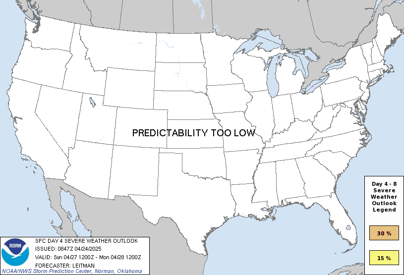
You are looking at an outlook that is part of the medium range forecast (the outlook for days 4-8). The most important thing to note is that lack of a risk does not mean zero risk. Generally speaking, confidence has to be pretty high for the Storm Prediction Center to have an outlook area this far into the future.
When no specific risk areas are shown, you might see one of these phrases:
- Predictability Too Low: This means that severe storms might be possible, but forecasters aren't confident enough about where or when they might occur. Think of it as the models showing different possibilities, like pieces of a puzzle that haven't come together yet.
- Potential Too Low: This means forecasters are fairly confident that widespread severe weather is NOT expected on that day. While isolated storms might still occur, the chance of reaching severe criteria across any given area is very low.
If you bookmark this page, it will continue to update with each new outlook that is issued.
Days Covered in this Outlook
| Day 4 | Sunday, April 13 | predictability too low |
| Day 5 | Monday, April 14 | 15% |
| Day 6 | Tuesday, April 15 | predictability too low |
| Day 7 | Wednesday, April 16 | predictability too low |
| Day 8 | Thursday, April 17 | predictability too low |
Detailed Outlook
ZCZC SPCSWOD48 ALL ACUS48 KWNS 100833 SPC AC 100833
Day 4-8 Convective Outlook NWS Storm Prediction Center Norman OK 0333 AM CDT Thu Apr 10 2025
Valid 131200Z - 181200Z
DISCUSSION
Primary feature of interest will be a shortwave trough over MT at 12Z Sunday and its major amplification into a broad eastern CONUS/southeast Canadian trough through mid-week. Poleward moisture quality from the western Gulf will remain sub-optimal, but will improve through D5/Monday. The northeast extent of weak surface buoyancy should reach the OH Valley by Monday afternoon, where guidance has been trending farther south with an intense mid-level jet. Given a prior EML and the deep surface cyclone tracking over Lake Superior to central ON vicinity, convective coverage may be limited along the trailing cold front. Still, consensus of guidance suggests that some fast-moving convection should accompany the portion of the front in the OH Valley vicinity. Robust 700-500 mb wind profiles should offer at least a threat for damaging winds.
Depending upon timing of frontal passage, a limited-area severe threat may exist on D6/Tuesday along the Southeast Atlantic coast. A compact southern-stream shortwave impulse, approaching the backside of the broad east CONUS trough, indicates low-probability severe potential over the southern Great Plains on D7/Wednesday into the western Gulf Coast vicinity D8/Thursday.
..Grams.. 04/10/2025
CLICK TO GET WUUS48 PTSD48 PRODUCT
National Risk Overview
- Thursday, April 10
- TORNADO: low
- HAIL: 15%
- WIND: 15%
- Friday, April 11
- TORNADO: 2%
- HAIL: 5%
- WIND: 5%
- Saturday, April 12
- ANY SEVERE: low
- Sunday, April 13
- ANY SEVERE: predictability too low
- Monday, April 14
- ANY SEVERE: 15%
- Tuesday, April 15
- ANY SEVERE: predictability too low
- Wednesday, April 16
- ANY SEVERE: predictability too low
- Thursday, April 17
- ANY SEVERE: predictability too low
Your Severe Outlook
Risks for this location
- Thursday, Apr 10 TORNADO low HAIL low WIND low
- Friday, Apr 11 TORNADO low HAIL low WIND low
- Saturday, Apr 12 ANY SEVERE low
- Sunday, Apr 13 ANY SEVERE low
- Monday, Apr 14 ANY SEVERE low
- Tuesday, Apr 15 ANY SEVERE low
- Wednesday, Apr 16 ANY SEVERE low
- Thursday, Apr 17 ANY SEVERE low
Severe Weather Definitions
- Tornado
- Any size tornado is considered severe.
- Wind
- Winds 58 mph and greater.
- Hail
- 1" and larger hail.
- "Any Severe"
- For outlooks for days 3-8, it could mean a threat of any or all of the following: wind, hail, or tornadoes.
For black colored risks that means there is an enhanced threat of significant severe weather. Depending on the threat, this could mean 75 mph and greater winds, 2" and larger hail, or EF2 and stronger tornadoes.
Hi, I'm Hayley. Did you know that I run this site out of my own pocket? So if you'd like to help out and you're already planning on buying something off of Amazon, why not use our Amazon Severe Weather Outlook link before you buy and we'll get a tiny portion of your purchase.
About Severe Weather Outlook . com
SWO started as a spinoff project of wickedwx, but has since replaced the site.
- tornado hq - live severe weather warnings
- cyclocane - hurricanes/typhoons/cyclones
- tornado solitaire - play cards while you monitor the US severe weather threat
- tertremo - live view of earthquakes around the world
- earthquake solitaire - get live earthquake updates as you play your favorite card game

